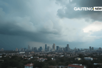
A strong weather alert has been issued for Tuesday, 22 July 2025, warning of severe thunderstorms in parts of the Eastern Cape and a cold front sweeping through KwaZulu-Natal (KZN). The South African Weather Service (SAWS) has called on residents in affected regions to stay vigilant, as extreme weather conditions are expected to bring potential hazards, including flooding, hail, and icy temperatures.
ALSO READ: Gauteng Weather: Cool, Clear Start to the Week with Mild Winter Temperatures
Severe Thunderstorms in the Eastern Cape
Residents in the northeastern parts of the Eastern Cape should prepare for severe thunderstorms, which may include heavy rain, lightning, and small hail. Areas along the Wild Coast are particularly at risk.
The expected impact includes:
- Localised flooding in low-lying areas and informal settlements
- Disruption to traffic due to slippery roads and poor visibility
- Damage to vehicles and crops from hail
- Isolated power outages caused by lightning or fallen trees
Communities in storm-prone areas are urged to secure outdoor items, stay indoors during storms, and monitor weather updates regularly.
Cold Front Hits KwaZulu-Natal
In KwaZulu-Natal, a cold front is bringing icy conditions, light rainfall, and overcast skies across the province. The southwestern interior will experience particularly cold temperatures, with highs ranging between 13°C and 15°C.
Key weather features for KZN include:
- Morning fog patches inland, reducing visibility for early commuters
- Cold and wet conditions throughout the day, especially in Pietermaritzburg and surrounding towns
- Breezy coastal conditions with occasional showers
Residents are encouraged to dress warmly, avoid unnecessary travel during fog or rain, and take care on slippery roads.
Snowfall Expected Over Mountainous Areas
The cold front is also expected to bring light snowfall to higher-lying regions in Lesotho, the Drakensberg, and parts of the Eastern Cape highlands. This could affect mountain passes and routes used by delivery trucks and tourists.
Travellers should plan accordingly, use snow chains where necessary, and avoid driving in poor visibility.
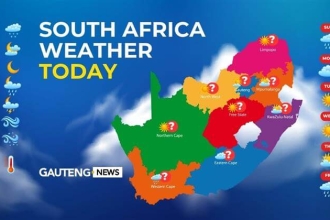
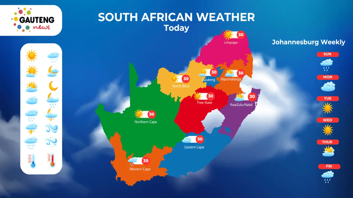
National Weather Overview
Here’s a brief summary of conditions across other provinces on 22 July 2025:
- Gauteng: Cold and partly cloudy, with early morning fog in some areas.
- Mpumalanga: Drizzle expected in the Lowveld by afternoon, with fog along the escarpment.
- Limpopo: Mostly clear at first, becoming cloudy with evening showers in some areas.
- Free State & North West: Cold to cool, with isolated showers.
- Western Cape: Overcast with morning rain in parts of the west.
- Northern Cape: Cold with morning fog and isolated showers in some areas.
Most provinces will experience cool to cold conditions, especially overnight, with wind chill making it feel even colder in exposed areas.
What’s Causing the Weather Alert?
This weather alert is the result of a strong cold front moving in from the southwest. As it pushes eastward, it interacts with warm, moist air over the eastern interior, triggering thunderstorms and lowering temperatures dramatically.
The system is expected to pass by midweek, but lingering cold and wet conditions may continue in some parts until Thursday.
Safety Tips During the Weather Alert
With changing weather patterns, it’s essential to take precautions:
- Stay indoors during thunderstorms and avoid using electrical appliances.
- Keep warm by wearing layered clothing and using blankets or heaters safely.
- Avoid flooded roads, and do not try to cross fast-moving water.
- Drive carefully, especially in fog, hail, or wet road conditions.
- Check for updates from SAWS or local authorities before travelling.
Preparedness is key when dealing with unpredictable weather.
What to Expect Later This Week
After the cold front moves eastward, conditions will gradually clear up in most areas by Wednesday. However, cold temperatures will persist, especially in inland regions such as Gauteng, Free State, and the Northern Cape.
In coastal areas like Durban and Port Elizabeth, occasional showers may continue until Thursday, with warmer temperatures returning by the weekend.
Stay Updated
It’s important to keep up with official forecasts during this weather alert. The South African Weather Service provides regular updates on changing conditions. You can view the latest forecast and warnings here.
CHECK OUT: Today’s Weather Forecast – 22 July 2025