Today’s Weather Alert
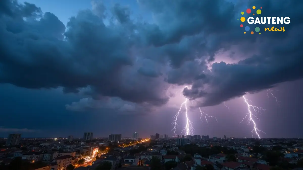
The South African Weather Service (SAWS) has issued a Yellow Level 2 warning for severe thunderstorms expected to impact several provinces on Thursday, 27 February 2025. The forecast warns of heavy downpours, damaging winds, excessive lightning, and hail, which may result in localized flooding and damage to infrastructure.
Which Provinces Are Affected?
The severe weather conditions are expected to hit five provinces:
- Mpumalanga
- North West
- Northern Cape
- Free State
- KwaZulu-Natal
Additionally, extremely high fire danger has been forecasted in parts of the Northern Cape, increasing the risk of wildfires.
Impact-Based Weather Warnings
1. Severe Thunderstorms (Yellow Level 2 Warning)
Residents in the affected provinces should brace for:
✔ Heavy rain – Potential flooding in low-lying areas.
✔ Strong winds – Risk of damage to property and power outages.
✔ Excessive lightning – Increased chances of wildfires and electrical disruptions.
✔ Hailstorms – Possible damage to vehicles, crops, and infrastructure.
Communities in these areas should take precautions, including securing outdoor furniture, avoiding low-water bridges, and staying indoors during storms.
2. Fire Danger Warning
🔥 The western parts of the Northern Cape face extremely high fire danger conditions, meaning fires can spread rapidly due to dry and windy weather. Residents and farmers are urged to avoid open flames, burning debris, and outdoor activities that may spark wildfires.
What to Expect in Your Province on 27 February 2025
Here’s a detailed provincial breakdown of the weather forecast:
Gauteng
🌦 Partly cloudy and warm, with isolated afternoon showers and thundershowers.
☀ UV Index: High – Sun protection is advised.
Mpumalanga
🌫 Morning fog patches along the escarpment.
⛈ Scattered thunderstorms expected along the escarpment and Highveld.
🌤 Partly cloudy and cool to warm in other areas.
Limpopo
🌫 Morning fog patches over the escarpment.
🌤 Partly cloudy and warm to hot.
🌧 Scattered thundershowers along the southern escarpment.
North West
🌤 Partly cloudy and warm to hot.
⛈ Scattered showers and thunderstorms, more likely in western parts.
Free State
☁ Partly cloudy and warm to hot.
⛈ Scattered thunderstorms, except for isolated cases in the northeast.
Northern Cape
🌫 Morning and evening fog patches along the coast.
☀ Mostly fine and hot, but scattered thunderstorms expected in the east.
🔥 Fire danger warning remains in place.
Western Cape
☁ Partly cloudy, with isolated light rain along the south coast.
🌤 Mostly warm and dry in the rest of the province.
Eastern Cape (Western Half)
🌫 Morning fog patches in places.
☁ Cloudy and warm, with isolated showers and rain in the evening.
Eastern Cape (Eastern Half)
☁ Cloudy and cool but warm in northern areas.
⛈ Scattered showers and thunderstorms inland, with isolated rain along the coast.
KwaZulu-Natal
🌫 Morning fog over the interior.
⛈ Cloudy and cool to warm, with scattered thunderstorms in the extreme west.
Safety Tips During Severe Weather
1️⃣ Avoid Flooded Areas – Do not attempt to cross flooded roads or bridges.
2️⃣ Secure Outdoor Items – Prevent damage from strong winds and hail.
3️⃣ Unplug Electronics – Reduce the risk of power surges from lightning.
4️⃣ Stay Indoors – If possible, avoid unnecessary travel during storms.
5️⃣ Be Prepared for Power Outages – Charge devices and keep emergency kits ready.
What’s Next?
The SAWS will continue to monitor the situation and provide updates as conditions evolve. The severe thunderstorms are expected to last into the evening, so residents should stay alert and follow official warnings.
For live updates, tune in to local news stations or visit the SAWS website. Stay safe, South Africa!